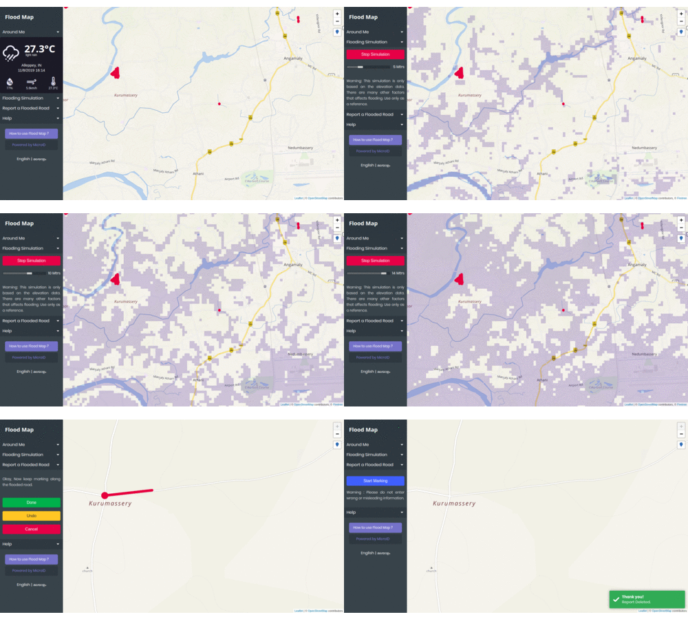
This project aims to help people to find safer routes to travel during a flood. Users can mark and unmark flooded or unsafe roads on the map anonymously. A live version of this project can be found here.
Warning !! This project uses GeoLocation API and should be served from a secure origin.See Here.
- Clone this repo to your public folder.
- Import 'FloodData_Template.sql' into your MYSQL database.
- Update the database configuration in 'backend/db.php'.
- Inspired from osm-in/flood-map
- Base Tile Layer - OpenStreetMap India
- Elevation Tile Layer - FloodTree.net
