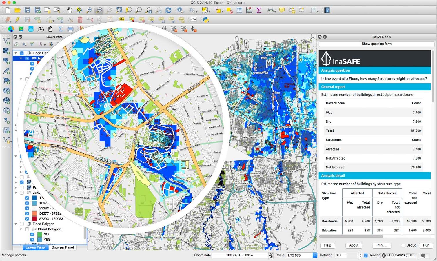
InaSAFE is free software that allows disaster managers to study realistic natural hazard impact scenarios for better planning, preparedness and response activities. InaSAFE is a plugin for QGIS.
For more information about InaSAFE and its documentation please visit inasafe.org.
The latest source code is available at https://github.com/inasafe/inasafe, which contains modules for risk calculations, GIS functionality and functions for impact modelling.
- Current Travis test status master:
- Current Landscape code health master:
- Current Travis test status develop:
- Current Landscape code health develop:
- PyPi Downloads for InaSAFE:
- PyPi Downloads for the old 'safe' library (currently unmaintained):
- Github download:
You first need to have QGIS installed. Grab your free copy from the QGIS download page.
To install the InaSAFE plugin, use the plugin manager in QGIS:
Plugins → Manage and Install Plugins
Then search for "InaSAFE", select it and click the install button. The plugin will now be added to your plugins menu.
Note: You may need to restart QGIS if upgrading from a prior version.
We work under the philosophy that stakeholders should have access to the development and source code, and be able to participate in every level of the project - we invite comments, suggestions and contributions. See our milestones list and our open issues list for known bugs and outstanding tasks. You can also chat live with our developers and community members using the link below.
- A standard PC with at least 4GB of RAM running Windows, Linux or Mac OS X
- The QGIS Open Source Geographic Information System (http://www.qgis.org). Although InaSAFE will probably run on any version of QGIS version above 2.0 or newer, our supported version is the latest Long Term Release version of QGIS.
- InaSAFE is using the Unittest Python framework.
- Different ways that you can run tests:
- On Travis using a Pull Request
- In QGIS Desktop if you enable
developer modein Plugins -> InaSAFE -> Options -> Advanced, restart QGIS and then click the run tests button. - Using docker
make docker-test - Using PyCharm if you set up the dev environment with the qgis_prefix_path
- In March 2011, Risk In A Box (the predecessor to InaSAFE) was built as a web application running as a GeoNode Plugin.
- InaSAFE development as a QGIS plugin started in January 2012.
- In October 2012, version 1.0 of InaSAFE was launched at the 5th Asian ministerial conference on disaster risk reduction (AMCDRR) where it was demonstrated to the then president of Indonesia, Susilo Bambang Yudhoyono who praised the project.
- On 30 Jan 2013, InaSAFE was awarded the prestigious Black Duck Open Source Rookie of the Year Award.
- Version 2.0 of InaSAFE was released in January, 2014.
- Version 3.0 was released in March 2015 which added support for using the QGIS API within impact functions.
- Version 4.0 was released in March 2017.
- Version 5.0 was released in November 2018 which add support for QGIS 3.x
InaSAFE has been jointly developed by the Indonesian Government-BNPB, the Australian Government, the World Bank-GFDRR and independent contributors. These agencies and the individual software developers of InaSAFE take no responsibility for the correctness of outputs from InaSAFE or decisions derived as a consequence.
InaSAFE is free software: you can redistribute it and/or modify it under the terms of the GNU General Public License version 3 (GPLv3) as published by the Free Software Foundation.
The full GNU General Public License is available in LICENSE.txt or http://www.gnu.org/licenses/gpl.html
There is no warranty for the program, to the extent permitted by applicable law. Except when otherwise stated in writing the copyright holders and/or other parties provide the program "as is" without warranty of any kind, either expressed or implied, including, but not limited to, the implied warranties of merchantability and fitness for a particular purpose. The entire risk as to the quality and performance of the program is with you. Should the program prove defective, you assume the cost of all necessary servicing, repair or correction.
In no event unless required by applicable law or agreed to in writing will any copyright holder, or any other party who modifies and/or conveys the program as permitted above, be liable to you for damages, including any general, special, incidental or consequential damages arising out of the use or inability to use the program (including but not limited to loss of data or data being rendered inaccurate or losses sustained by you or third parties or a failure of the program to operate with any other programs), even if such holder or other party has been advised of the possibility of such damages.

